StreetsSD Interactive Street Condition Map
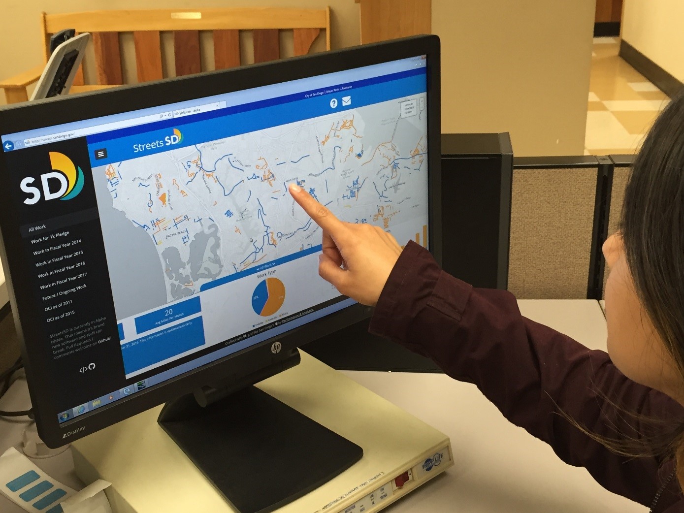
The City of San Diego’s new StreetsSD application (app) is one of the most innovative and capable online street maps of any major U.S. city. It makes detailed information about the City’s roads and road repairs available with just a click or tap. The app updates automatically so residents have the most accurate data on streets in every neighborhood allowing them to select the quickest and safest routes to and from their homes, work and other activities. The app continues San Diego Mayor Kevin L. Faulconer’s push to create a City government as innovative as the people it serves and helps illustrate his commitment to completing at least 1,000 miles of road repairs in five years. City crews and contractors are active daily with road improvement projects throughout the City. The Mayor has said, “We’ve got all this great information about streets and now we’re sharing it with the public through this really cool tool that makes it easy for everyone to access.” In the past, residents had to comb through reams of paperwork, PDFs and spreadsheets to figure out which streets have been repaired, where repairs are being planned and what condition their street is in – if they could find the information at all. Now all that is at their fingertips. StreetsSD provides: • The latest condition status of streets: Displays the Overall Condition Index (OCI) of every assessed street in categories of Good (70 to 100 OCI), Fair (40 to 69 OCI) or Poor (0 to 39 OCI). • Historical assessment data: Includes results from the 2011 citywide assessment study, which allow users to compare how a street has improved or worsened in the past five years. • Which streets have been fixed recently: Shows types of street repairs (slurry seal, asphalt paving or concrete replacement) that have occurred since July 2013 (Fiscal Year 2014). • Which streets are scheduled for future repair: Updates regularly to identify which streets have upcoming repairs. • How far along the City is on the Mayor’s road repair goal: Notes progress toward the goal to repair at least 1,000 miles of streets over five years. This interactive tool was developed in-house to help the public keep track of the street repair program and hold the City accountable. The underlying data for the StreetsSD map is also directly available to the public via the City’s open data portal (data.sandiego.gov). Street repair information on StreetsSD is updated quarterly whereas citywide assessments are point-in-time studies that remain unchanged until the next assessment is conducted. This app is another in a series of civic engagement tools the City has recently deployed that uses data to improve residents’ experiences when they connect with City Hall. Now, with the support of Mayor Faulconer and the City Council, the City of San Diego is turning a corner on understanding its data and using it to enhance transparency, efficiency, and accountability as well as helping make local streets and roads safer through the use of Streets
Add Comment