San Jacinto Trails Master Plan
Location
Citywide
City or County Responsible for Project
City of San Jacinto
Category
Complete Streets Projects
Author
Rene Yarnall
City of San Jacinto
595 S San Jacinto Ave
9514877330
Project Description
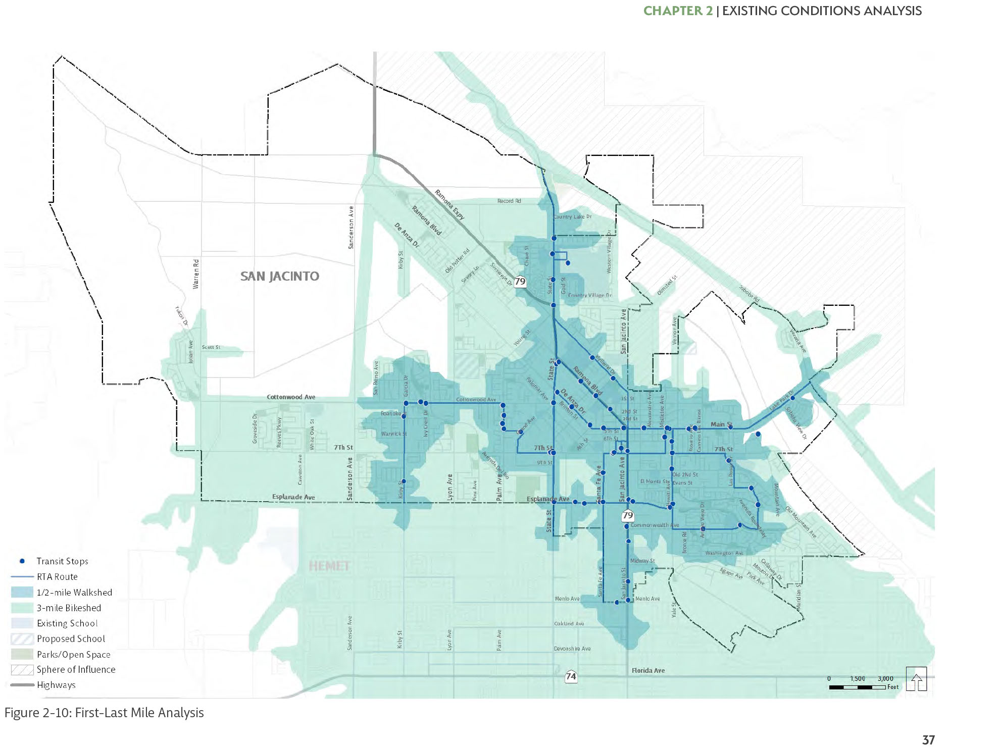
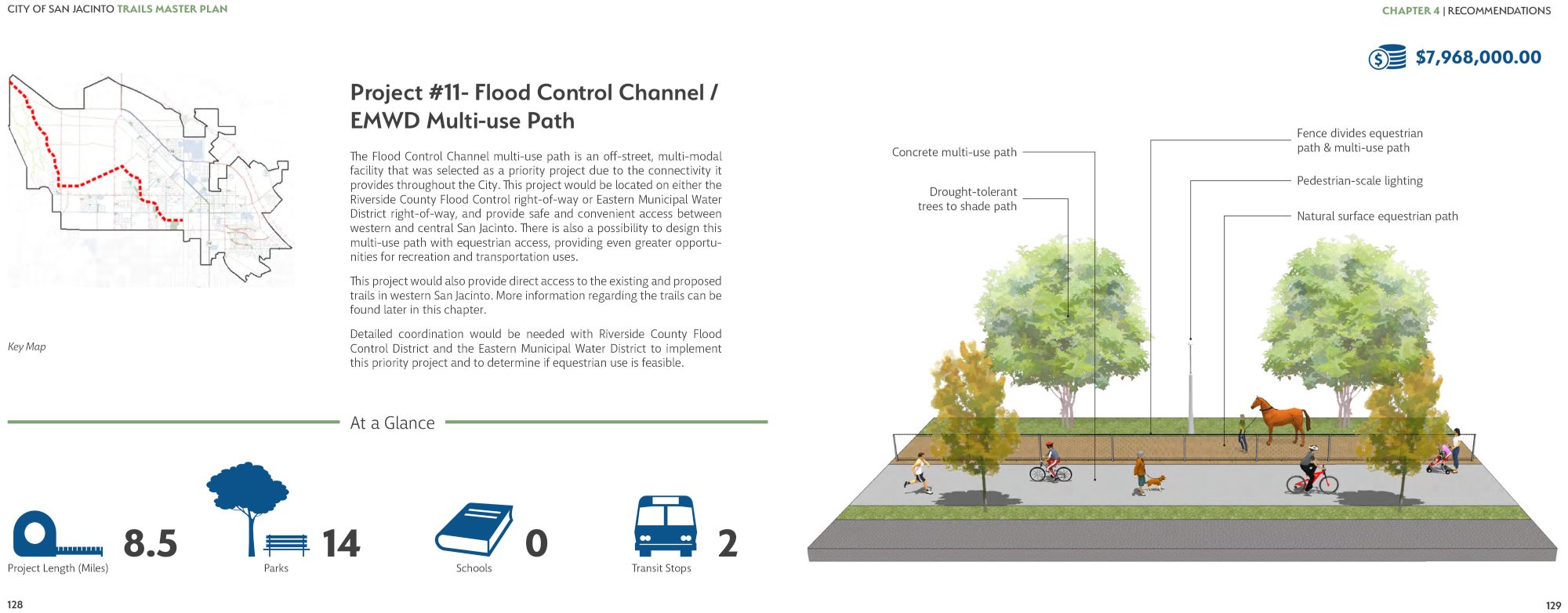
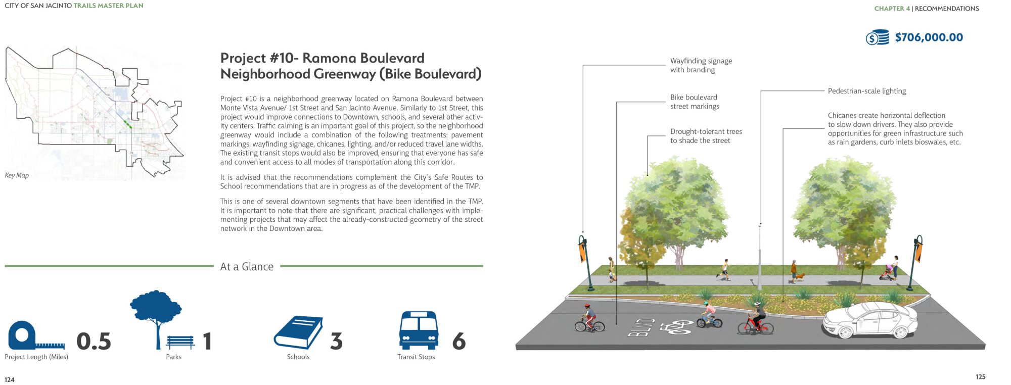
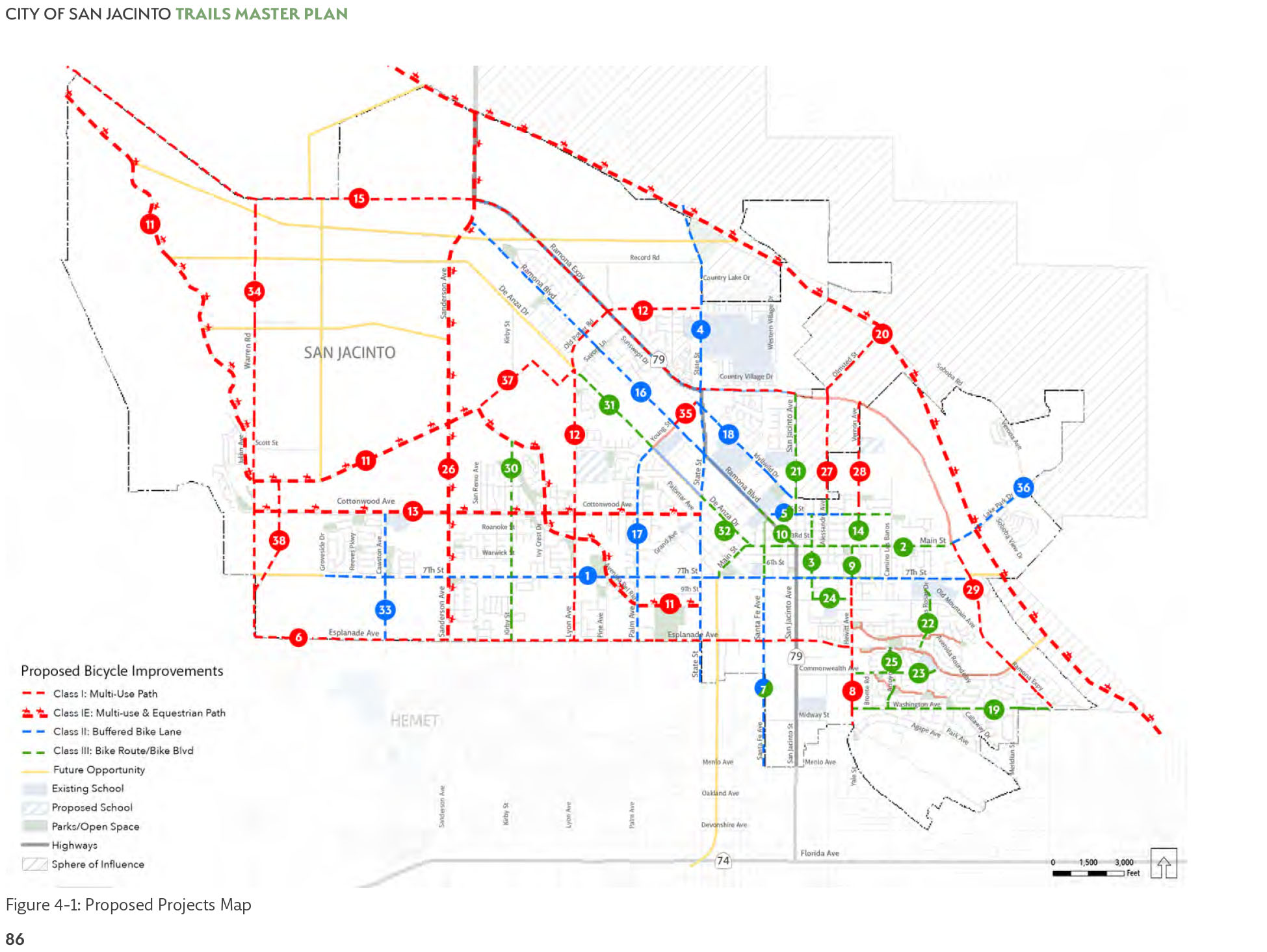
The San Jacinto Trails Master Plan (SJTMP) is a comprehensive planning document that provides a strategic framework for the future development of a fully connected, multi-use, non-motorized trails network. The plan summarizes the City’s existing trail and multi-modal conditions to develop project recommendations that make multi-modal transportation safe and an enjoyable option. The plan strongly promotes public health through active transportation, street safety, environmental health and more. The plan aligns with regional non-motorized transportation plans and addresses sustainable community planning goals and objectives. What is unique and exemplary of the SJTMP is that its focus and priority was to establish a network of Class 1 multi-use trails, which are widely considered the safest and most comfortable facilities for people of all ages. The SJTMP supports the research suggesting that Class 1 multi-use paths make people feel the safest and are most enjoyable. While connectivity and convenience remain essential quality indicators for both bicycling and walking systems, research indicates that the increased acceptance and actual practice of daily walking and bicycling requires “low-stress” facilities. Furthermore, a network of fully protected corridors, such as those recommended in the SJTMP, also contributes to a reduction in GHG’s because not only are people choosing to walk, bike, or hike to their destinations, but the facilities themselves provide the actual space to plant trees and increase the urban forestry that will contribute to additional GHG reduction. The analyses conducted in the SJTMP included spatial (GIS) analysis, fieldwork, and community and stakeholder input. This multi-pronged approach allowed for maximum data capture and cross-referencing of findings. The safety analysis included identifying pedestrian and bicycle collisions over a five-year period (2012-2016). This process provided for an understanding of potential physical improvements that would address safety concerns and minimize future collisions as well as help prioritize projects along corridors and intersections with high collision rates. A total of 38 projects were identified as the best corridors to establish a network of complete streets. Of these 38 projects, a total of 11 trail/bikeway corridors and three pedestrian-focus corridors were identified as high-priority projects. These projects, which add up to 82 miles of multi-use paths and enhanced bikeway facilities, represent the corridors the community recognized would best establish a multi-modal network that would improve the comfort and safety for people. Additionally, the plan provides recommendations on how to successfully implement and maintain the proposed improvements.
Add Comment