Laurel Lane Complete Streets and Roadway Sealing
Location
Laurel Lane (Orcutt to Johnson Ave) and misc. locations
City or County Responsible for Project
City of San Luis Obispo
Category
Complete Streets Projects
Author
Jennifer Rice
City of SLO
919 Palm Street
8057817058
Project Description
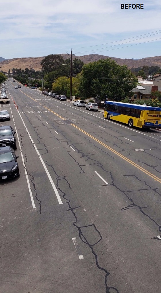
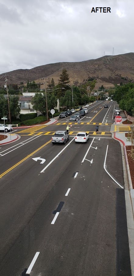
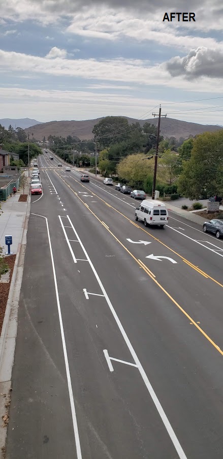
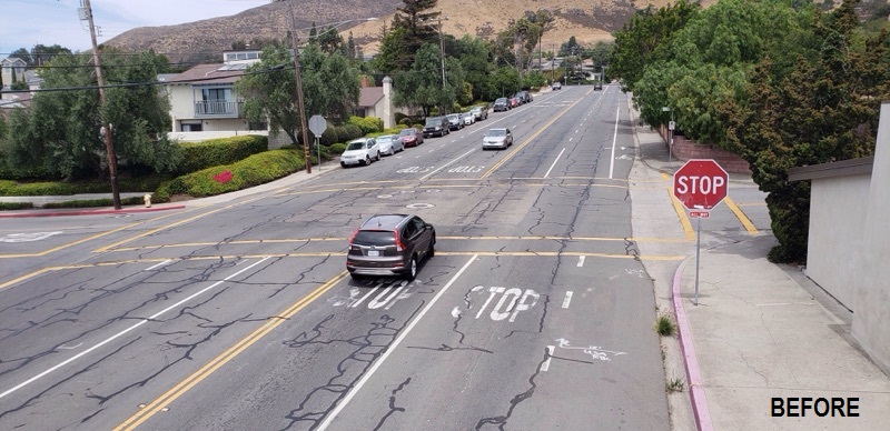
The City of San Luis Obispo’s Pavement Maintenance Plan was adopted in 1998 and uses a rotating method to provide regular preventative and corrective maintenance to City streets. One goal of this plan is to maintain 70% of the City’s 130 centerline miles of streets in good condition, as measured by the Pavement Condition Index. During the summer of 2018, the City implemented the pavement management plan by slurry sealing approximately 560,000 square feet of neighborhood streets (about 20% of City street surface area). Additional work included pavement repairs and slurry sealing of the 0.56 mile Laurel Lane arterial roadway, which incorporated new complete streets modifications. The “Roadway Sealing and Laurel Lane Complete Streets” project was implemented at a total construction cost of $2.42 million. The complete streets component amounted to approximately $400,000 of the total project cost. Prior to project implementation, Laurel Lane had been identified in the City’s Traffic Safety Program as having the highest-ranking intersection for pedestrian collisions. The corridor was recommended to be considered for a road diet in order to reduce the crossing distance and number of conflicts for pedestrians. Laurel Lane is over 80 feet wide and previously consisted of four travel lanes (two in each direction), 6-foot bike lanes and parking on one or both sides depending on the segment. Daily volumes range from 7k to 10k vehicles/day with prevailing vehicle speeds between 30 and 45 miles per hour. Over 180 pedestrians cross Laurel Lane daily: school children and parents accessing the elementary school and regional park, seniors accessing senior living and transit services, neighbors accessing the community garden and local marketplace. After a year of community outreach and planning, the list of improvements on Laurel Lane included reduced travel lanes to one in each direction with a two-way center turn lane, buffered bike lanes and intersection improvements to the two all-way stop intersections including sidewalk bulbouts and hi-visibility crosswalk markings. The improvements reduced the pedestrian crossing distance by 10 feet and removed a point of conflict by reducing the lanes. The configuration presents safety features for drivers as well by providing a two-way center turn lane that can be used as a refuge for left turning vehicles. About 30 new on-street parking spaces were included in the project. Laurel Lane complete streets project creates a neighborhood corridor that is comfortable for all users, particularly improving the environment for pedestrians and bicyclist of all ages and abilities. Slurry sealing of the surrounding neighborhood streets preserves the existing pavement, lowering future maintenance and rehabilitation costs and further enhances neighborhood livability.
Add Comment