Intelligent Transportation Systems (ITS) – Phase V
Location
Citywide
City or County Responsible for Project
City of Santa Clarita
Category
Safety or Intelligent Transportation System Projects
Author
Damon Letz
City of Santa Clarita
23920 Valencia Boulevard, Suite 304
661-255-4982
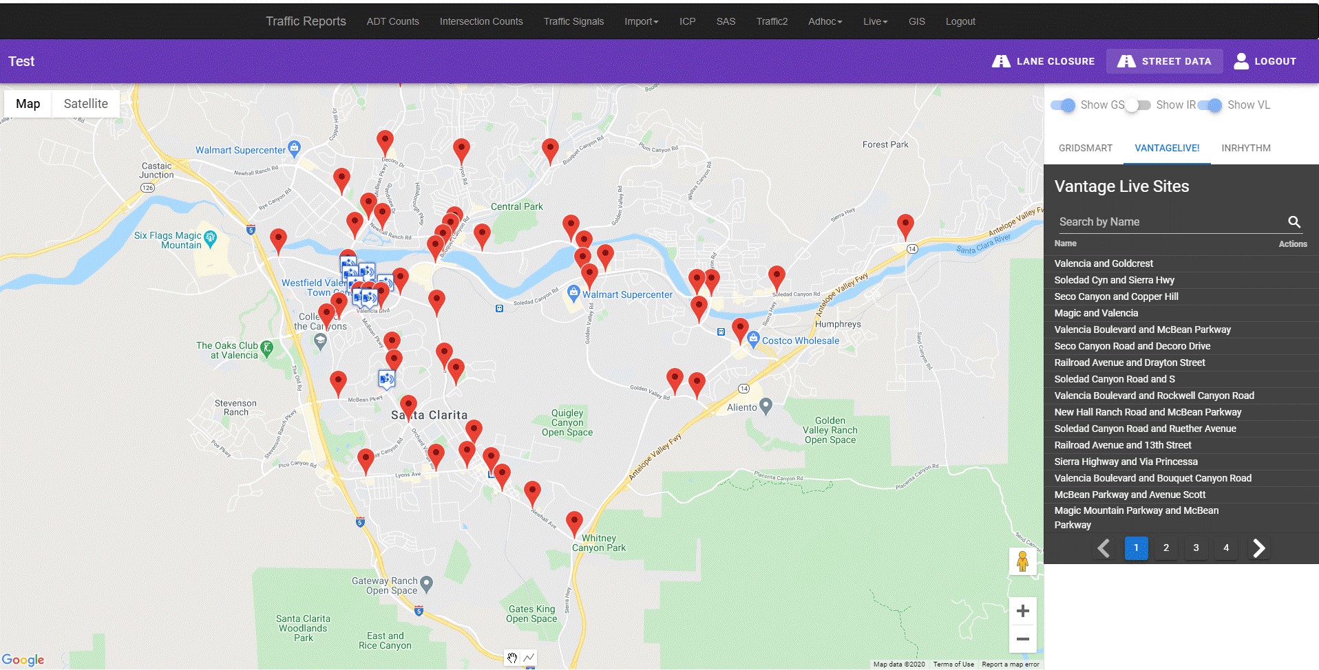
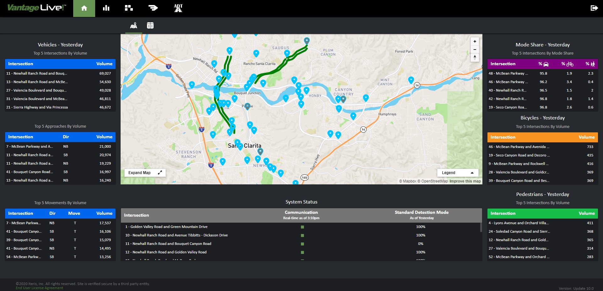
Project Description
The City of Santa Clarita is tasked with balancing and accommodating a variety of users on its roadway system. The City’s population has grown by nearly 50% in the last two decades, causing an influx of users and changing traffic patterns on City roads. Unlike other cities that have a traditional roadway grid system, Santa Clarita’s roadway system is shaped by the natural topography of the area that includes rolling hills, rivers and creeks. This has resulted in an irregular roadway network with wide arterials and highly directional peak traffic. Some portions of the City are only served by one major roadway. This has made transportation planning a challenge, making it difficult to detour traffic from congested roads and subjecting roadway users to increased travel time. Therefore, the use and implementation of technology to make the roadway system more efficient is critical. A major component of the Intelligent Transportation System (ITS) Phase V project, completed in 2020, is the deployment of automated traffic count systems at more than 60 signalized intersections. This deployment included a mix of upgrading existing cameras with new processors and installation of new equipment. The automated traffic count system collects and provides real-time data to the City and has proven to be an invaluable tool to City staff. The data used from the automated counts has assisted staff in evaluating lane assignments at intersections to increase capacity and reduce congestion and develop conditions of approval on proposed projects to maintain circulation. The City also utilizes the automated traffic count system’s Application Programming Interface (API) that automatically exports collected data into the city-maintained traffic database. Staff can now compare or validate data with other systems already integrated into the City’s database such as Average Daily Traffic counts, Turning Movement Counts, and Travel Time systems. Another benefit of using the API feature to the City’s database is the ability to view data remotely without having the need to be in the Traffic Operations Center. Data from the automated counts will also be used to initially develop and implement adaptive signal operation on 12 corridors and 118 intersections in the City. The adaptive signal software allows traffic signals to adjust timing to optimize traffic flow for real-time conditions. After implementation of adaptive signals, the automated traffic count system will play an integral role to continuously feed traffic count data. This project builds upon previous ITS phases that has invested heavily into implementing technology that has yielded various benefits such as improved mobility, real-time and effective monitoring of traffic conditions, reducing staff time in field, remote access to the traffic signal system, robust data collection, and increased driver satisfaction.