Cook Riolo Multi-Use Pathway
Location
Cook Riolo Road/Baseline Road (Roseville)
City or County Responsible for Project
Placer County
Category
Complete Streets Projects
Author
Jean Hanson
Placer County
3091 County Center Drive, Auburn, CA 95670
530.745.7553
Project Description
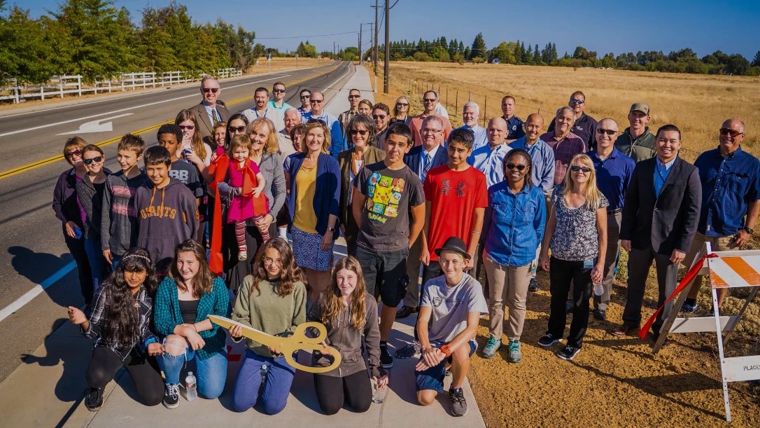
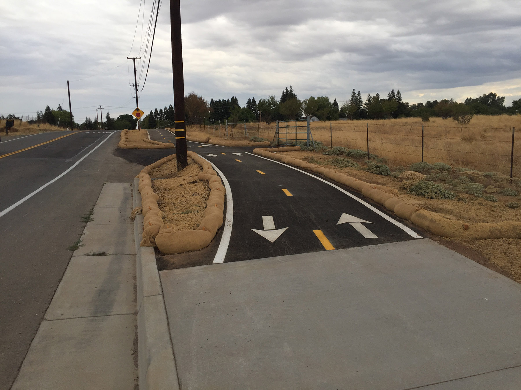
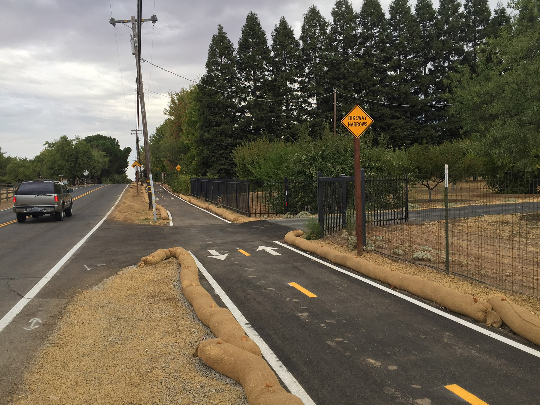
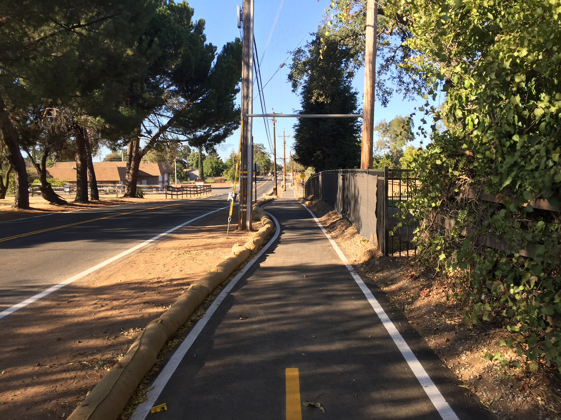
October 11, 2018 was the date of the ribbon cutting ceremony for the Cook Riolo Multi-Use Pathway project. This truly community-oriented project was a success for Placer County, Dry Creek Joint Elementary School District and local residents in providing safe access for pedestrians and bicyclists to and from Creekview Ranch Middle School and the Dry Creek Greenway recreational area. This project provides an important link between the Dry Creek Community and City of Roseville and is consistent with Complete Streets principles. The effective land use has encouraged future construction of facilities within the area. Cook Riolo Road, a north-south two-lane collector, extends south from Baseline Road towards the Sacramento County line. The travel lanes are typically 11 feet wide with limited paved shoulders which present pedestrian and bicycle safety concerns without an existing pathway or bike lanes. The pathway provides an all-weather surface connecting to existing sidewalk. Improving the overall quality of Cook Riolo Road, pedestrians and bicyclists are now using the pathway and no longer need to travel along the edge of road. Cook Riolo Road is now a facility accommodating safe non-motorized modes of transportation while preserving its functionality and unique rural characteristics.With a typical width of 8 feet and 4,300 feet long, the pathway is located on the east side of Cook Riolo Road from Creekview Ranch Middle School to Baseline Road. Partnering with California Department of Transportation, Placer County received a grant to construct this community project which cost approximately $2.9 million with a combination of funding from Federal Congestion Mitigation and Air Quality (CMAQ) funds, Regional Surface Transportation Program (RSTP) funds and local road funds. By threading the pathway between trees, fences and utilities, and keeping adequate distance to road traffic, utility relocation and right-of-way acquisition were limited, resulting in cost and time savings. Additionally, since a portion of the pathway is in a floodplain, the vertical profile, grading, driveways and drainage features were coordinated to not cause additional flooding of the road and properties. The project maintains existing drainage patterns and provides sustainable and environment-friendly erosion control features that blend into the area. The hydroseeded swales not only convey storm water, but also serve as a water quality feature. In collaboration with Dry Creek Joint Elementary School District, Dry Creek Community and the project team, Placer County gained support for the project by meeting several times with individual property owners to provide project details, as well as adjusting the pathway design to limit right-of-way and environmental impacts. The County also presented the project to the public at the West Placer Municipal Advisory Council meetings. During construction, Placer County continued open communication with property owners and other stakeholders.
Add Comment