City of Santa Cruz Branciforte Creek Bicycle/Pedestrian Bridge and Multi-Use Trail Project
Location
From the existing Riverwalk path under the Soquel Avenue Bridge and over Branciforte Creek to San Lorenzo Park, Santa Cruz, CA 95060
City or County Responsible for Project
City of Santa Cruz
Category
Bridge: Efficient and Sustainable Bridge Maintenance, Construction and Reconstruction Projects
Author
Janice Bisgaard
CIty of Santa Cruz
809 Center Street, Santa Cruz, CA 95060
831 420 5166
Project Description
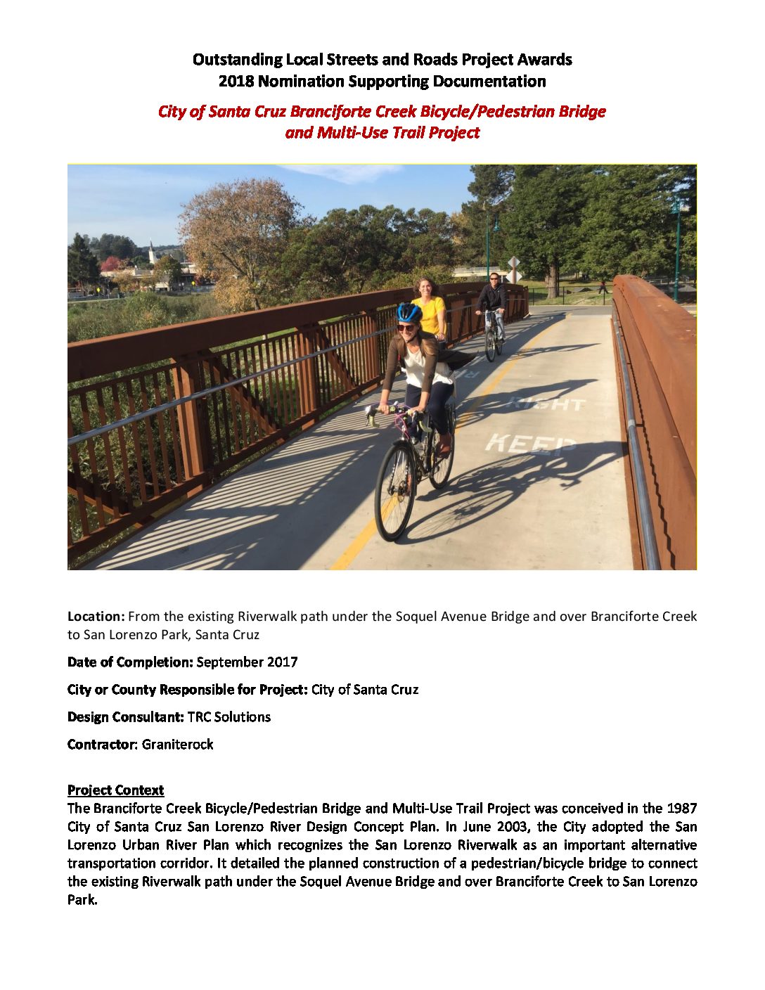
The Branciforte Creek Bicycle/Pedestrian Bridge and Multi-Use Trail Project meets terms outlined in the City of Santa Cruz 2003 Lorenzo Urban River Plan recognizing the San Lorenzo Riverwalk as an important alternative transportation corridor and outlining the construction of a pedestrian/bicycle bridge to connect the existing Riverwalk path under the Soquel Avenue Bridge and over Branciforte Creek to San Lorenzo Park. Until the completion of the Branciforte Creek Bicycle/Pedestrian Bridge and Multi-Use Trail Project in September 2017, there was a gap in the Riverwalk. For years, cyclists and pedestrians had to leave the levee pathway system and use City streets in order to cross Branciforte Creek. Thanks to a California State Active Transportation Program grant, the Branciforte Creek Bicycle/Pedestrian Bridge and Multi-Use Trail Project has finally eliminated this gap completing a fully separate pathway for pedestrians and cyclists traveling on the Riverwalk that keeps them safe from motor vehicle traffic. The two key features of the project were the construction of a new bike/pedestrian bridge across Branciforte Creek and the completion of the levee trail system along the middle and eastern reach of the San Lorenzo River. The bridge crosses Branciforte Creek from San Lorenzo Park and is 126 feet in length. The paved multi-use trail connects to the levee trail south of the Soquel Avenue Bridge. The trail connection goes under the Soquel Avenue Bridge and adjacent to the bridge abutment, as the trail does at the City’s other San Lorenzo River bridges. The project has greatly increased use of the Riverwalk by creating a continuous, convenient, safe and comfortable facility for cyclists and pedestrians. Riverwalk provides the community with an alternative commute route connecting employment, retail, schools and recreational areas with neighborhoods. The vital connection is designated part of the Safe Routes to School network and serves the Harvey West neighborhood, Beach/Boardwalk area, downtown, County Government Center and Metro Bus Center. Interconnections exist with cross-town bike lanes, sidewalks and other paths. Both UC Santa Cruz and Santa Cruz City School District students regularly use the pathway. Riverwalk also serves educational and environmental purposes as it brings the public closer to and within the natural environment. The project is helping to increase walking, biking and safety in Santa Cruz while serving a wide spectrum of active transportation users. The project supports the City’s new Go Santa Cruz initiative which includes the City’s ongoing work to expand active transportation facilities and reduce greenhouse gas emissions. It is also part of the City’s 2020 Climate Action Plan aimed at reducing greenhouse gases by 30% over a 10-year period.
Add Comment